Why Roads Follow Valleys, Streams, and Settlements
Why roads follow valleys becomes clearer when you trace streams and settlements: learn to read the corridor and understand why a route bends or climbs.
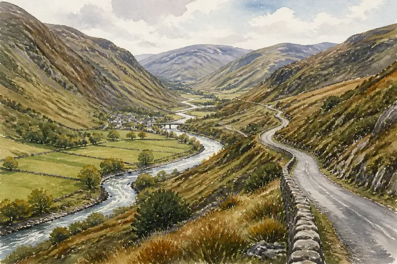
Why roads follow valleys is easier to see where a road keeps to a hillside while a stream twists along the bottom. The route is using the valley as a corridor, but it is also negotiating water, soft ground, crossings, and the places people need to reach.
A valley is more than a gap between ridges. Its floor, stream, side valleys, terraces, and settlements form a connected geography. Together they help explain why a road may stay above the water, bend toward a village, or leave the corridor at a crossing.
Valleys connect places through a changing corridor
Valleys often offer a continuous way through a landscape that would otherwise require repeated climbs over ridges. But the corridor is not a single easy strip. It can widen into a settled basin, narrow between steep slopes, or split where a tributary joins the main stream.
That changing shape matters to movement. A broad floor may provide room for farms and buildings, while a constriction can funnel roads, water, and traffic through the same limited space. Roads tend to reflect these local differences rather than follow the valley center from end to end.
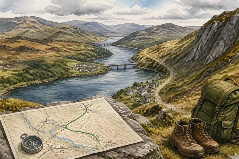
To read the route, use a topographic map alongside a road map. A printed map, an offline map app, and a notebook are sufficient. Follow the stream, note where tributary valleys enter, and mark settlements and bridges. Then ask what each change in the road’s line connects or avoids.
Streams shape the route without dictating it
Water identifies the valley’s low ground, but that ground may be damp, flood-prone, or occupied by the channel itself. A road may therefore run on a terrace, a raised shelf beside the valley floor, or a lower slope. Its distance from the stream can change as the banks and ground change.
Crossings are especially revealing. A road that approaches a stream may be heading for a bridge, ford, or another established crossing point. On a map, look for a bridge symbol, a road meeting the channel at a manageable angle, or routes converging on the same spot. The map can point to a likely crossing, but current access and conditions need separate checking.
Where a stream makes tight bends, the road may take a smoother line nearby or stay on the opposite side. A sudden gap between road and water may mark a steep bank, a terrace, or a settlement. Treat these as clues, not proof of the route’s original purpose.
Settlements give valley roads destinations
A road serves people as well as terrain. Villages, farms, junctions, and other settled places can draw a route away from the simplest line between two points. A bend that looks unnecessary on a small-scale map may connect the main valley corridor to a tributary settlement or a crossing used by several roads.
Settlement positions also reveal how people relate to the valley floor. Buildings may cluster where the floor broadens, beside a side stream, or on a slightly raised shelf. If the road turns toward such a place, the bend may reflect access as much as a change in slope.
Imagine an invented valley map with a road on the east side of a winding stream, a steep-sided reach ahead, and a village beside a tributary on the west. Trace the road first: it crosses the main stream below the village, curves toward the tributary, then continues through the wider valley. The resulting reading is that the crossing and village may explain the detour, while the broad floor provides the onward corridor. That interpretation fits the map’s visible relationships; it does not establish the road’s construction history.
A valley map rewards a sequence of checks
Use these observations to decide what to inspect next. Each item pairs a visible clue with a cautious interpretation and an alternative if the clue points elsewhere.
- Stream and road stay close: Check whether the road occupies a shelf above the channel. If the contours show a shelf, treat it as a possible route corridor; if they do not, consider that the map scale may hide the local terrain and check a larger-scale map.
- Road separates from the stream: Check for steep banks, a terrace, or a bend in the channel. If one appears, treat it as a possible reason for the separation; if none is visible, leave the cause open rather than assigning one.
- A bridge symbol appears: Check whether roads on both sides lead toward it. If they do, treat the crossing as a likely connection between valley sections; if they do not, check whether the bridge serves a local road or a place nearby.
- A tributary joins the main stream: Check whether a road turns into the side valley. If it does, consider whether it links a settlement or another route; if it does not, look for a separate path or road serving that branch.
- The valley narrows: Check for steep contours, a close-set stream, or a pinch between slopes. If the road shifts to one side, consider that side’s ground and crossings; if the map gives no clear clue, compare with a detailed view before drawing a conclusion.
- Buildings cluster on raised ground: Check whether the road runs through or around the cluster. If it connects directly, the settlement may help explain the alignment; if it bypasses the buildings, check for another nearby access road or a route serving the wider corridor.
These checks work best as a reading of relationships, not a method for claiming certainty from a map. Road alignments can change, and a present-day map records the current route rather than every decision that shaped it.
Why does a valley road change course?
Why does a road climb above a stream?
The lowest ground may be wet, constrained by the channel, or exposed to flooding. A higher shelf can offer a more continuous route, but a particular road’s history requires local evidence.
Why does a road bend toward a village?
The bend may connect the valley corridor to a settlement, a tributary, or a crossing. Check the map for those features before treating the curve as an obstacle imposed by the terrain.
Does every valley provide a useful route?
No. A valley may be steep-sided, marshy, blocked by water, or closed by a headwall. A ridge route or a neighboring valley may connect places more directly.
What should I check before walking a valley road?
Check the public route, access notices, weather, and terrain conditions, and keep clear of traffic and unstable slopes. For route-specific access or safety questions, follow local guidance and consult an appropriate authority.
Some explanations are not worth the effort
It is not worth measuring every curve or guessing at engineering details from a general map. Focus instead on the stream’s course, the valley’s narrowing and widening, the crossing points, and the settlements that coincide with changes in direction.
Why roads follow valleys often comes down to a practical compromise: the valley links places, while the road chooses a workable line around water and local obstacles. On your next map, follow the stream first, then trace the road’s departures from it. Those gaps are often where a crossing, terrace, or settlement makes the route’s logic easier to see.